Vital Signs Data
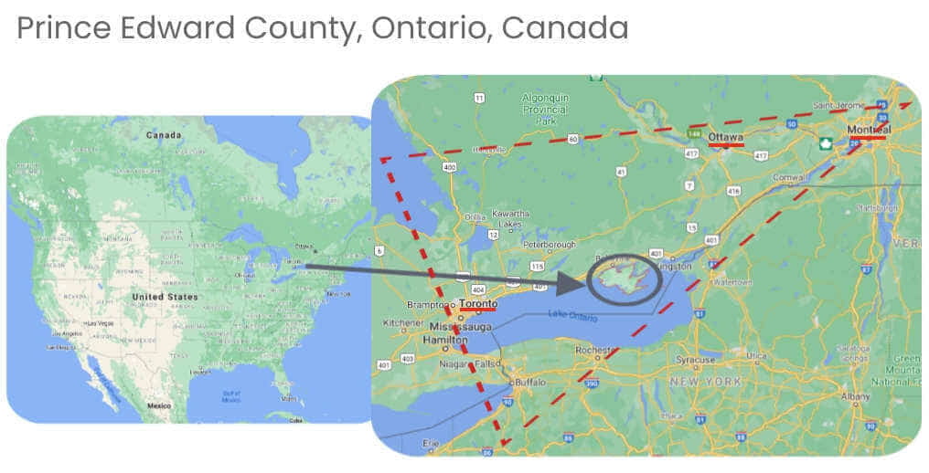
Location
Location
About
About
On the Statistics Canada Index of Remoteness, PEC ranks 0.15 which is considerably less remote than the median municipality rating of 0.30. (The scale is 0="least" remote to 1="most" remote). Geographic proximity to services centres and population centres is an important determinant of socio-economic and health outcomes.
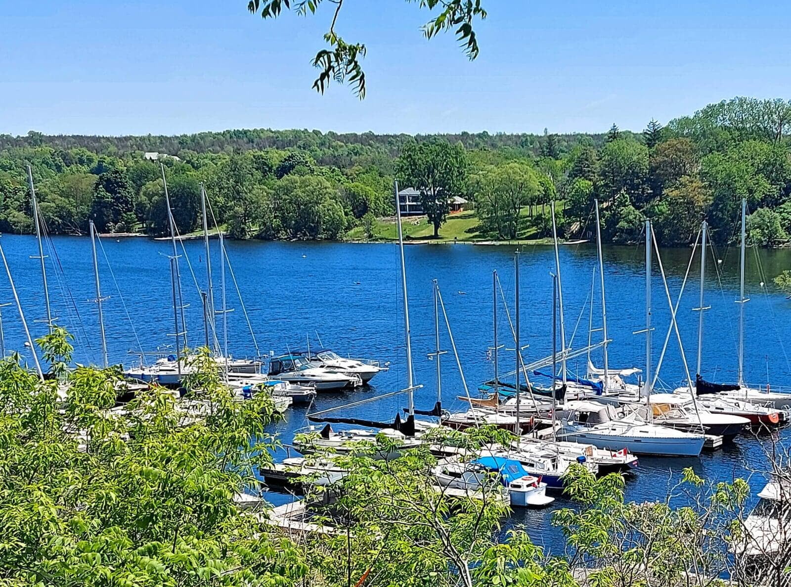
Our heritage buildings, vineyards and wide open spaces help to make us a favourite destination with people seeking peace and beauty. Sandbanks Provincial Park has one of Canada’s best beaches and the world’s largest freshwater sand and dunes system. The South Shore is an internationally recognized Important Bird Area and 750,000 migrating birds rest on the island in Spring and Fall. Prince Edward County's natural heritage and economy are enriched by its vibrant cultural history. The community proudly shares the highest concentration of artists in Ontario, tied with Stratford. The arts play a vital role in fostering a sense of connection among residents through diverse offerings such as theatre, festivals, music, and visual arts. (Hill Strategies Report)
Regional Services
Prince Edward County (known to many as “The County”) is a single-tier municipal government with city status that handles all municipal services.
For purposes of Statistics Canada, Prince Edward County is a census subdivision (geocode 351302).
Ontario Provincial Police – Prince Edward Detachment – Picton provides policing of land and waterways. Specialized units include drug enforcement, aviation, explosive disposal, search and rescue, canine and emergency response.
Ambulance - The county is served by 1 EMS station of Hastings-Quinte EMS.
Fire Safety - The mainly-volunteer Prince Edward County Fire Department operates from ten fire stations located throughout the municipality.
Due to its small population, Prince Edward County is combined with surrounding regions for some services and data, including:
- Hastings and Prince Edward County Health region (now amalgamated as part of the South East Health Unit)
- Hastings and Prince Edward District Board of Education
- Prince Edward – Lennox & Addington Social Services
- Highland Shores Children’s Aid (counties of Hastings, Northumberland and Prince Edward)
- Federal Economic Region (the Kingston metropolitan area and the counties of Frontenac, Hastings, Lennox and Addington, Prince Edward, and Renfrew)
- Provincial Economic Region (Bruce County, Durham Regional Municipality, Grey County, Haliburton County, Hastings County, Lennox and Addington County, Muskoka District Municipality, Northumberland County, Peterborough County, Prince Edward County, Simcoe County and Victoria County.)
- Quinte Conservation
- Bay of Quinte Provincial and Federal electoral districts
Information in this website that is specific to these regions is indicated: Prince Edward County (PEC); combined with Hastings County (HPE); or with Lennox and Addington County (PELA).
Land Acknowledgement
Situated on the traditional territory of Huron-Wendat, Anishinaabe, and Haudenosaunee peoples, PEC’s Official Plan speaks to the importance of the County’s Indigenous heritage. Tyendinaga Mohawk Territory is our neighbouring community.
The County Foundation acknowledges that we are on the traditional territory of Huron-Wendat, Anishinaabe and Haudenosaunee peoples. These peoples agreed to mutual sharing obligations and responsibilities as stewards of the land and water. We recognize that these are now our shared obligations in partnership, to continue to protect the land and water. As we talk about the land, we honour the Indigenous ancestors who came before us and who continue to be present in lands which we occupy. We acknowledge and honour the First Nations who despite attempts of colonialism, continue to hold and share their rich history, traditions and cultures that are proud, modern and vibrant. As we move forward, we hope that every time we get together we acknowledge all those that have come before us.
— Indigenous Land Acknowledgement is approved by Troy Maracle, Indigenous Education Lead for the Hastings Prince Edward District School Board.
A note about land acknowledgements
It is important that these words are paired with actions that further the goals of truth and reconciliation.